© All rights reserved - by qlddrones
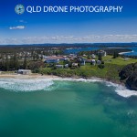
An aerial view of Clarence Point at Yamba, NSW, a popular beach holiday spot
Queensland Drones specialises in precision aerial mapping for agronomists, engineers, surveyors, developers, building designers and other commercial organisations. We utilise leading edge multi-constellation GNSS-equipped (PPK) UAVs to deliver centimetre level precision mapping in RGB colour, NIR for NDVI and Multispectral for Red Edge detection. We are CASA-Certified, fully insured and operate within a strong safety management framework that can be integrated into your site safety frameworks.